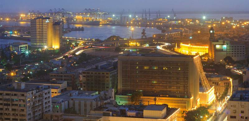
In this article, Nadeem F. Paracha takes you to the journey that Karachi went through over the course of centuries. Here’s a history of Pakistan’s largest, and world’s 6th largest, city from the time Alexander the Great invaded subcontinent in 326 BC to date.
Facts
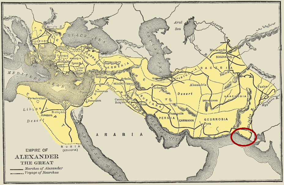
A 1910 map showing the empire of ancient Greek king and warrior, Alexander the Great. On the map is also a large area which today is in Pakistan. Alexzander entered the region in 326 BCE through the Khyber Pass. His forces fought their way across areas which today are in northern and central Pakistan. He exited the region by travelling south on River Indus across Sindh. After entering the region’s southern-most region (what today is Karachi) Alexander entered Babylon (ancient Iraq) through Makran in the present-day Pakistani province of Balochistan.
The area marked on the map with a red circle is where the forces of one of Alexzander’s admirals, Nearchus, arrived. That area is Karachi. According to Nearchus’ writings, ‘a great storm was raging’ when his men arrived here. He added that there was just a tiny village of ‘primitive fishermen’ here.
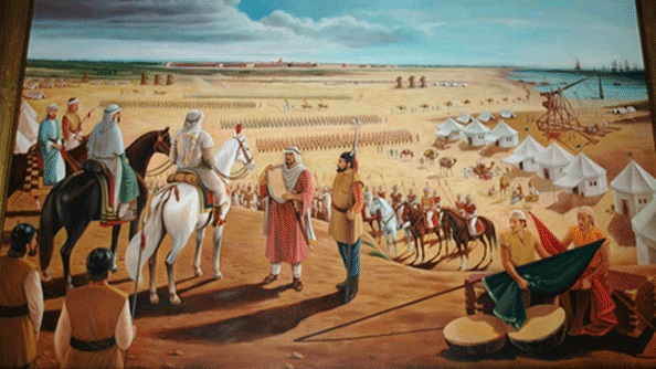
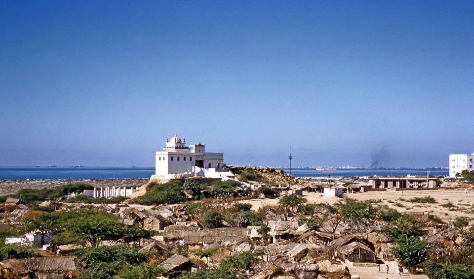
Undated painting of Arab commander Muhammad Bin Qasim and his army at Daybal. In 712 CE, Qasim invaded Sindh. The first city he conquered was Daybal. Daybal was near what today is Manora in Karachi. According to ancient Arab sources, Daybal was situated by the Arabian Sea. Sources also tell that the city was guarded by Rajput soldiers and was largely populated by Brahmins. In the 16th century, Arab navigator, Al-Mahri Umdah, called it ‘Ras Karasi.’
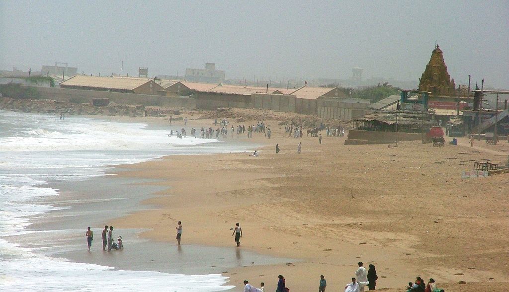
Manora today. An old Hindu temple can be seen in the background.
An early 19th century sketch of Daybal that had become ‘Dirbo’ in the 18th century. It was still a small fishing hamlet dependent on a fresh water pool. It also became known as ‘Kolachi Jo Kun’ (Kolachi’s Well). The population was a mixture of Hindus and Muslims. The main languages were Sindhi and Balochi. The Sketch was made by British traveler George Boyd.
Another old sketch by George Boyd. It is of an area which today is called Manghopir in Karachi. The sketch shows a Sufi shrine (of 12th century saint, Pir Mangu) and a pond with crocodiles.
Manghopir today. The pond still has over a hundred crocodiles.
An 1844 sketch by Thomas Studdert showing British soldiers stationed in Karachi. The British began their conquest of the city in 1839 CE. They defeated the forces of the Talpur dynasty. The British renamed the city, Karachi. The sketch shows British troops doing rifle practice in what today is the city’s PECHS area.
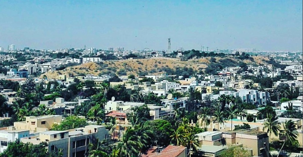
The PECHS today.
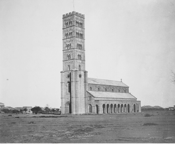
An 1860 photograph of one of the first churches to be built in Karachi. It was called Trinity Church and was completed in 1855. The British were the first Christian residents of Karachi.
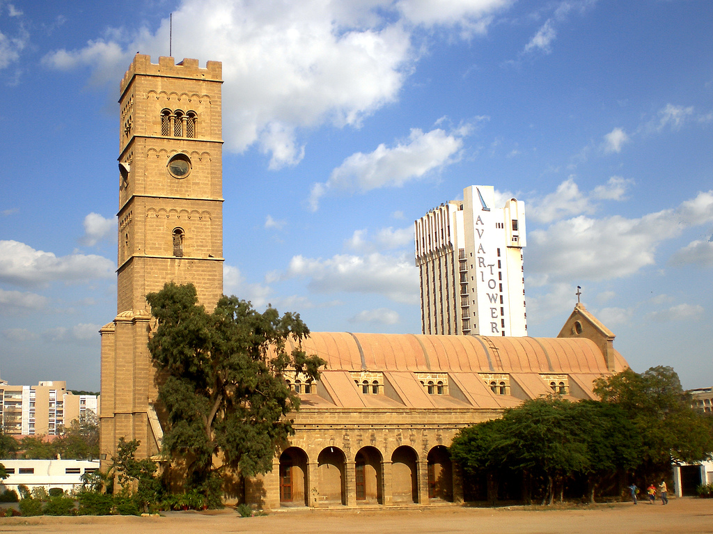
The Trinity Church today.
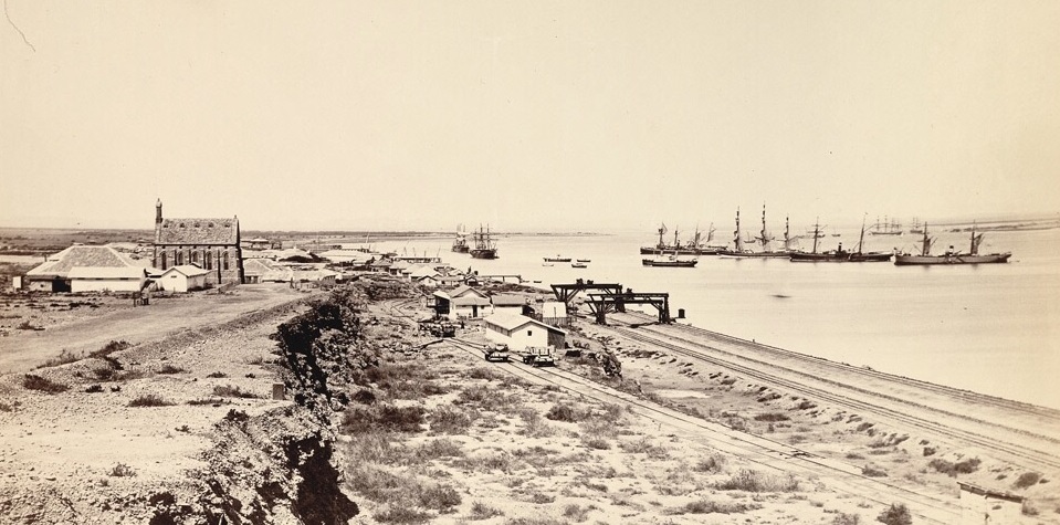
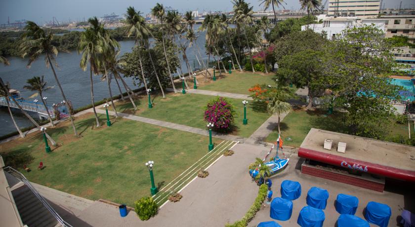
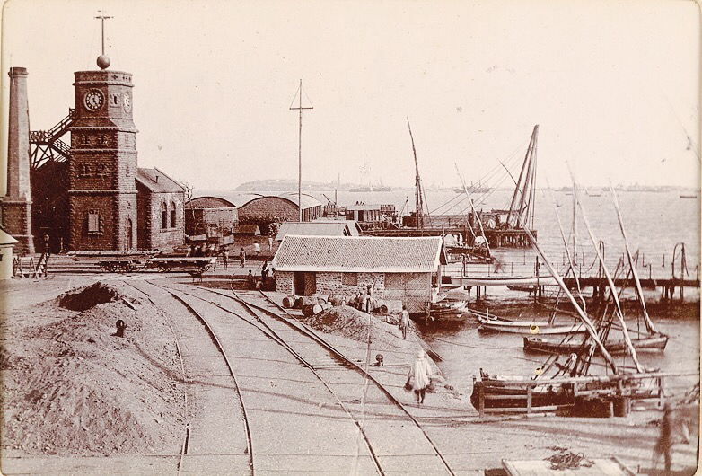
The Karachi Harbor in the 1870s. In the 1860s it had become an important harbor during the American Civil War when large amounts of cotton from Sindh were exported to the US government from here. This resulted in an economic boom which aided the once small town of Karachi to become a successful port city.
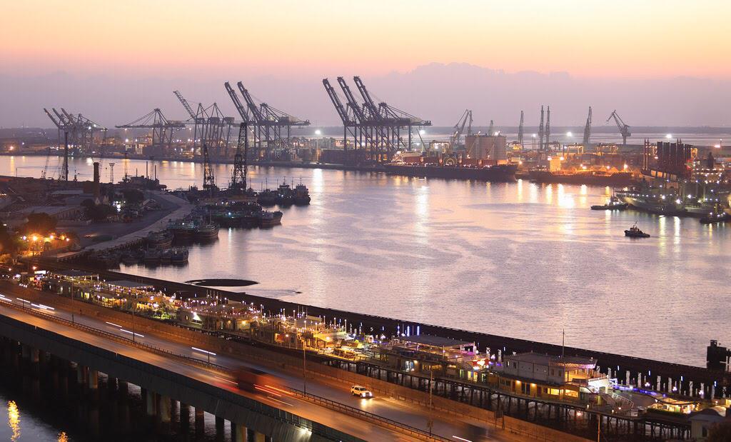
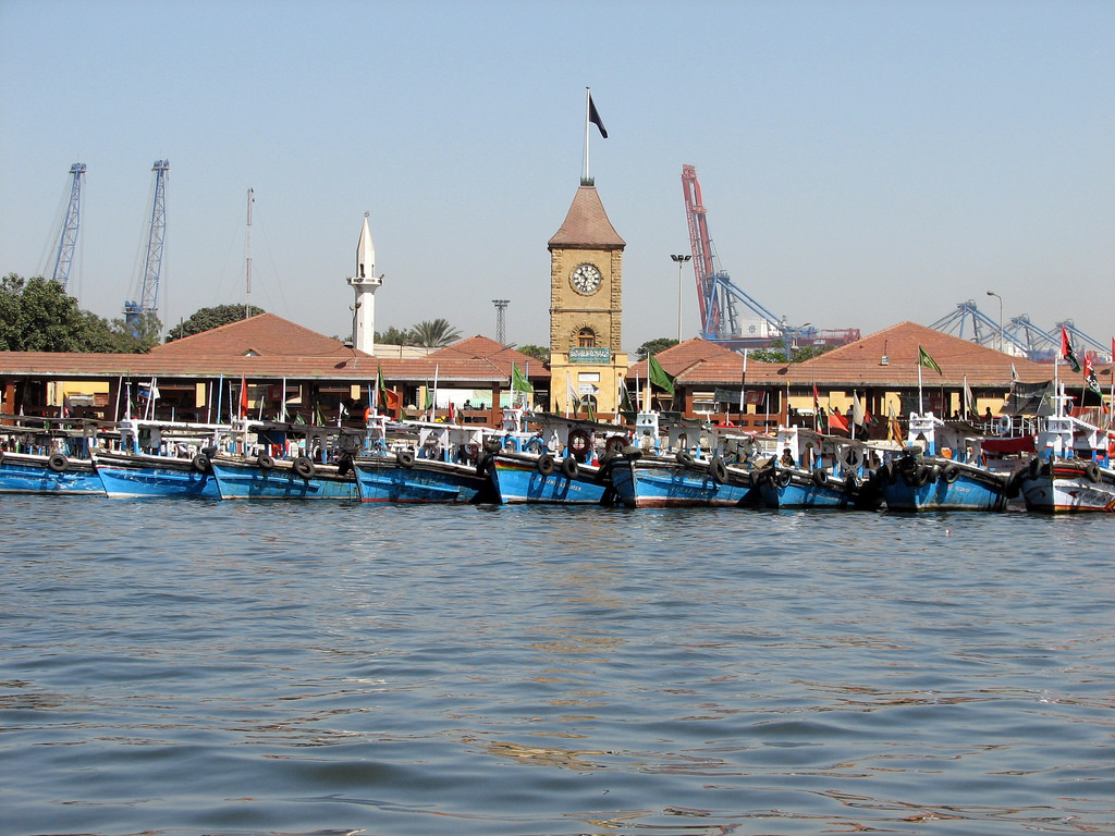
The Karachi Harbor today.
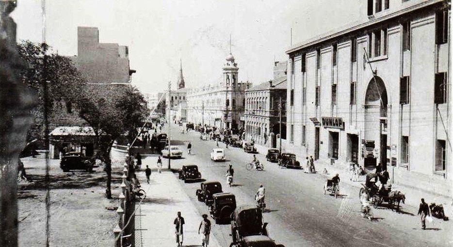
An 1890 photograph of Frere Road (now Fatima Jinnah Road).
Fatima Jinnah Road today.
Karachi’s Kharadar area in late 1890s. As the city’s size and economy grew, so did its population. Many migrants from the rest of India began to arrive and settle here. The city’s infrastructure began to collapse. In the 1890s, the bubonic plague swept the city, killing hundreds of people, especially those living in congested areas such as Kharadar.
Kharadar today.
The Clifton Beach in 1920s. Clifton was a barren seashore called ‘Hawa Bandar.’ The British began to build ‘summer homes’ here for themselves. Their families used to move into these houses during the city’s punishing summers. There were no fresh water connections here at the time, no electricity and only a rough road connected it with rest of the city. The British believed ‘Clifton air was good for health.’ From the mid-1920s, the city’s Zoroastrian families began to build permanent homes in Clifton, followed by rich Hindus and Muslims.
The Clifton Beach today.
The Karachi Airport being built in the late 1920s. It became the first ever airport in India.
The Karachi Airport in the 1960s. It became one of the busiest in the region at the time.
In 1992 a new airport, Jinnah International, was inaugurated in the city. It became Karachi’s second airport.
Elphinston Street in the 1930s (Saddar). Saddar was developed as a ‘posh’ shopping area by the British. It was lined up with high-end shops, stores and bars.
Elphinstone Street in the 1960s. Saddar remained to be a popular area after Pakistan’s creation. Between the 1950s and 1970s it became known for its busy bazars, nightclubs and bars.
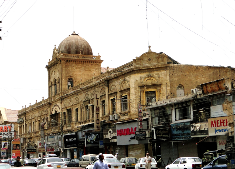
Elphinstone Street today. Saddar begn to lose its charm from the 1980s onwards.
A Congress Party rally being held at Karachi’s Patel Park in 1931. 51 percent of Karachi’s population at the time was Hindu.

People celebrate the creation of Pakistan at Patel Park in August 1947. The park’s name was changed to Nishtar Park.
A Pakistan People’s Party election rally at Nistar Park in 1970.
Nishtar Park today.
Goan Christian, Hindu and Muslim women on a shopping trip at Karachi’s Preedy Street area in 1948.
Preedy Street today.
Mcleod Road in the early 1950s. The British had developed this area as a financial district. In the 1960s, it was renamed I.I Chundhrigarh Road.
I.I Chundrigarh Road today. It began to be known as ‘the Wall Street of Pakistan.’
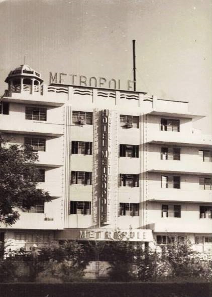
The Hotel Metropole in 1951. Built in 1950, it was the city’s first major hotel. It was also famous for its many restaurants and bars.
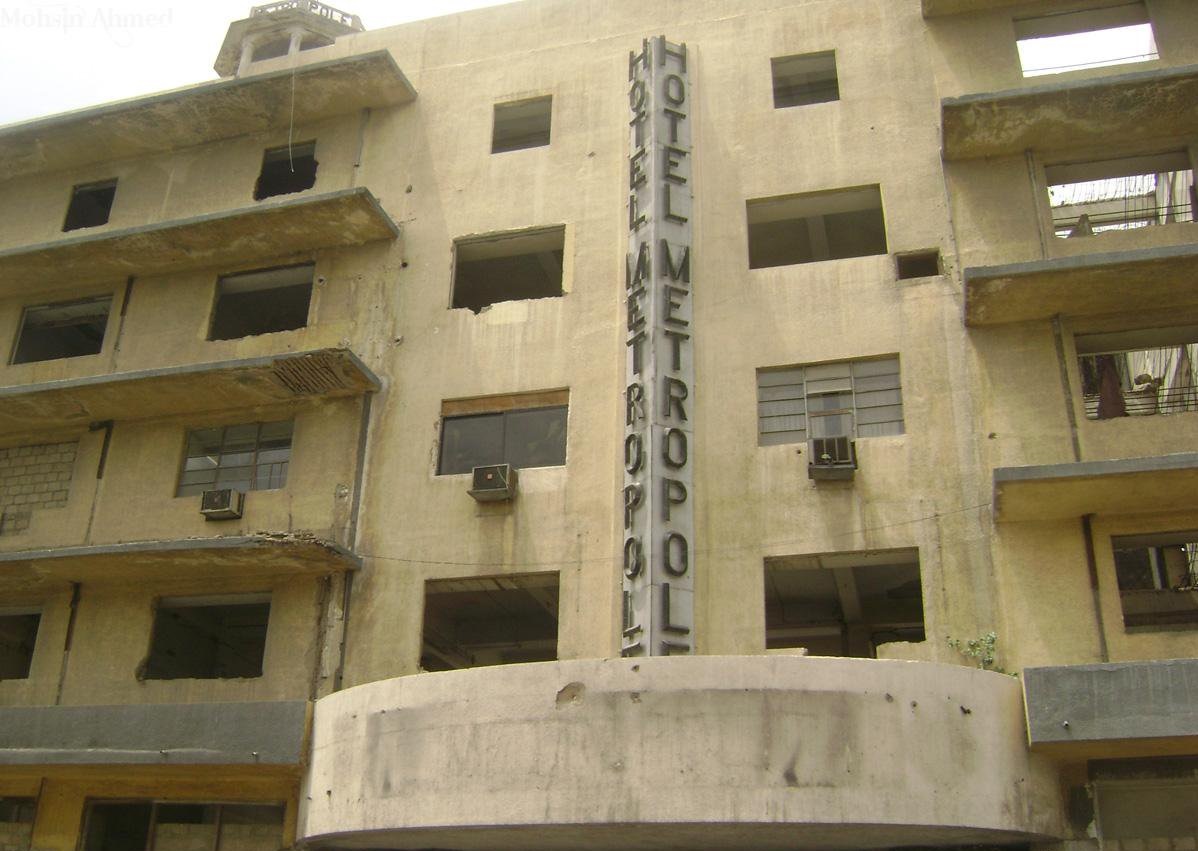
Today the famous hotel is being torn down to make way for a new building.
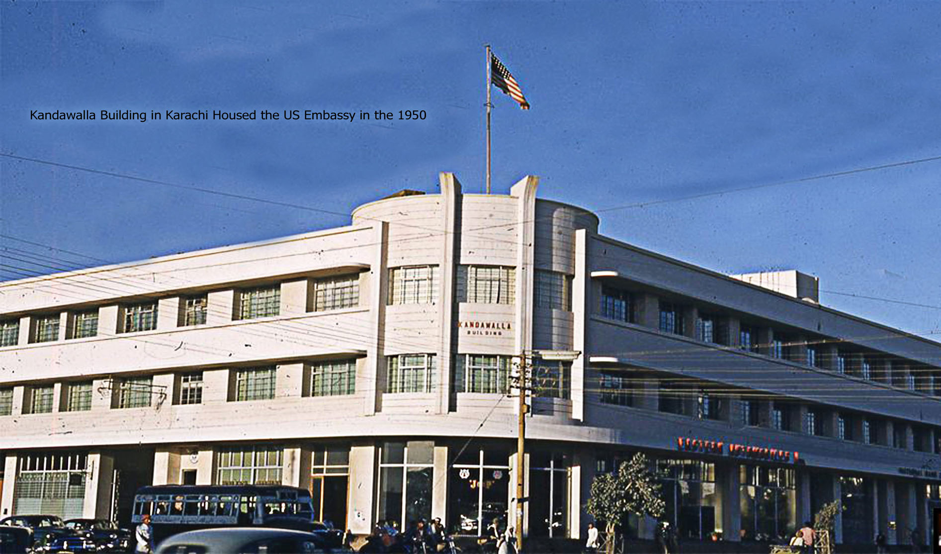
The first US Embassy in Pakistan was situated in the Kandawala Building on Bandar Road.
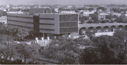
In 1961 the embassy moved to a building on Fatima Jinnah Road. The building was designed by the famous modernist architect Richard Neutra.
In 2011, the embassy moved to new premises on the Mai Kolachi Road.
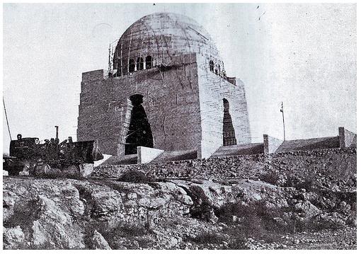
The mausoleum of Pakistan’s founder, Mohammad Ali Jinnah, being constructed in 1967. It was completed in 1970.
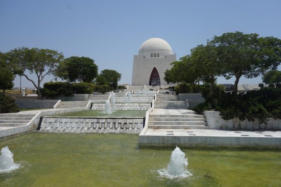
The mausoleum today.
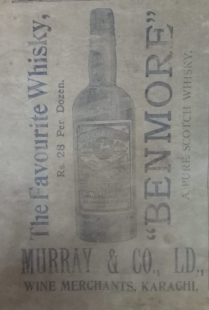
A press ad for Benmore whisky. Karachi was the largest market in Pakistan for local and imported alcoholic beverages. In April 1977 sale of alcoholic beverages was banned through an ordinance. The Ordinance lapsed in 1978. In 1979, a fresh ordinance was introduced. However, both the ordinances allowed sale of alcoholic beverages to non-Muslim Pakistanis and tourists. Even though bars, liquor stores and nightclubs were shut down, ‘licensed wine shops’ were allowed to sell to non-Muslims. 5 and 4 star hotels too were allowed to serve alcohol to tourists.
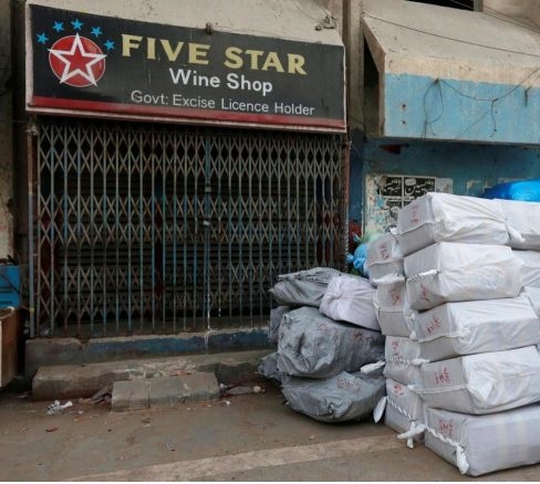
Karachi has the largest number of licensed wine shops in the country.
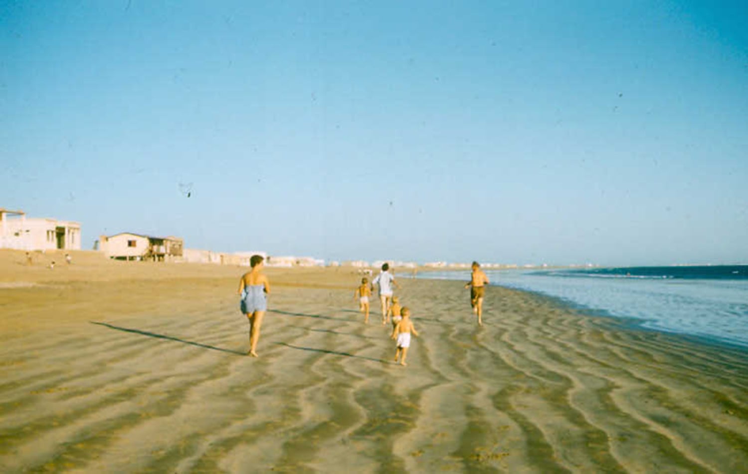
Western tourists at a beach in Karachi in 1964.
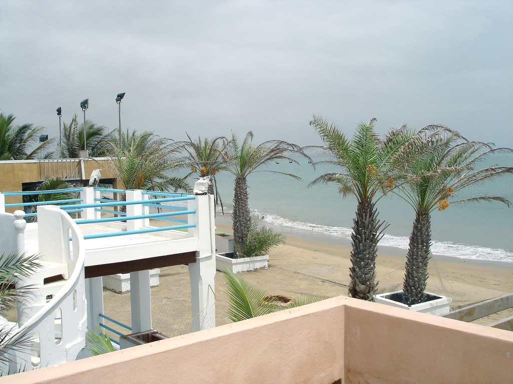
A Karachi beach today. There are over 10 beaches in the city.
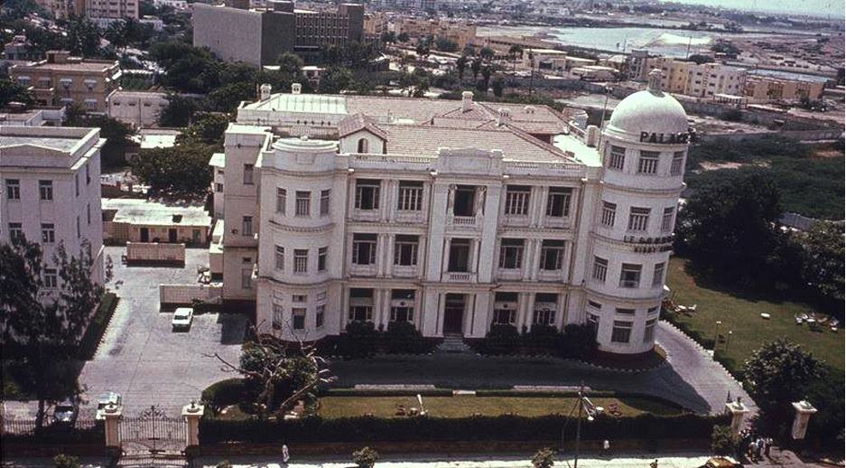
Karachi’s once famous Palace Hotel in 1963, the year it was declared to be ‘one of the best hotels of Asia.’ Situated on Club Road, Palace lasted till 1982 when it was torn down.
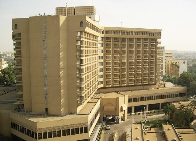
Palace Hotel was sold and then demolished in 1982. In its place, the Sheraton Hotel came up. Today it is called Movenpick Hotel.
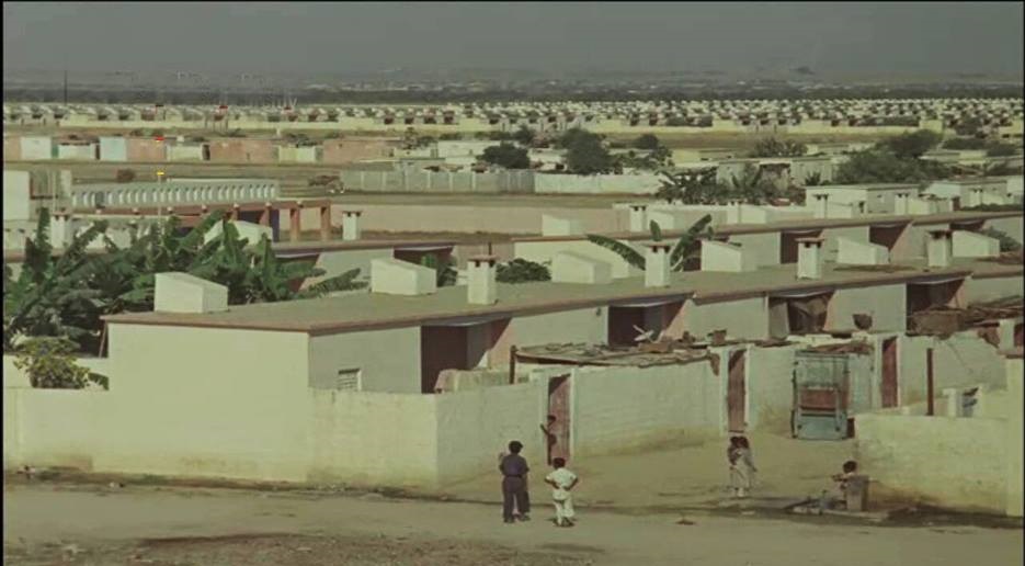
Korangi in early 1960s. This vast barren land was developed as a residential and industrial area in the 1960s.
Korangi today.
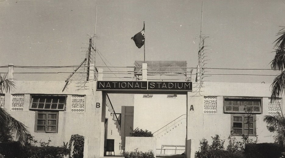
The National Stadium being built in the early 1950s. Completed in 1955, it became (and still is) Pakistan’s largest cricket stadium.
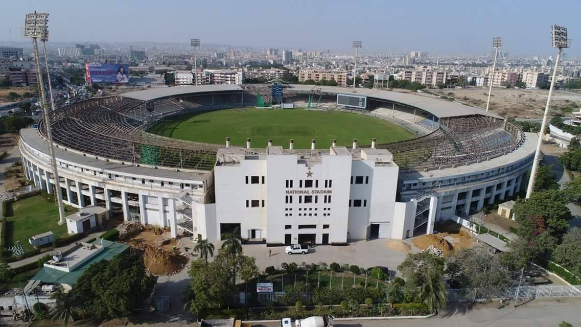
The National Stadium today.
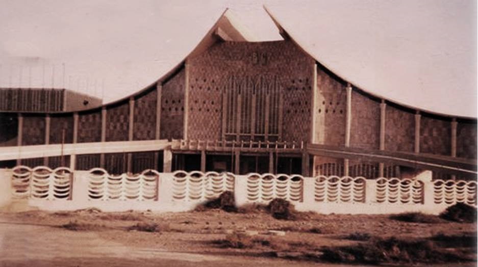
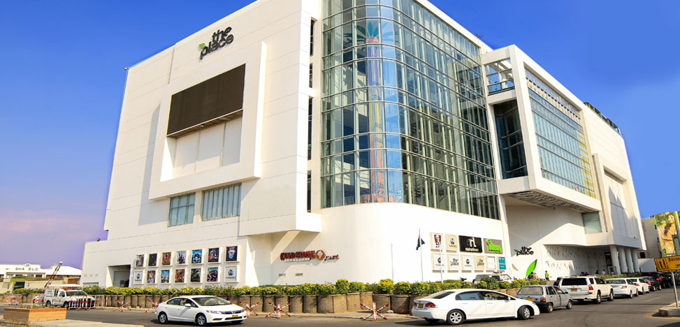
The casino which never opened. It was completed in 1977 and was situated in the Sea View area of Clifton. It was supposed to be one of the biggest casinos in the region. Its launch was scheduled for April 1977. However, its grand gala opening was cancelled when a protest movement by an alliance of right-wing parties forced the left-leaning ZA Bhutto government to ban alcohol and nightclubs. The building stood there aimlessly for decades until it was finally torn down in the early 2000s.
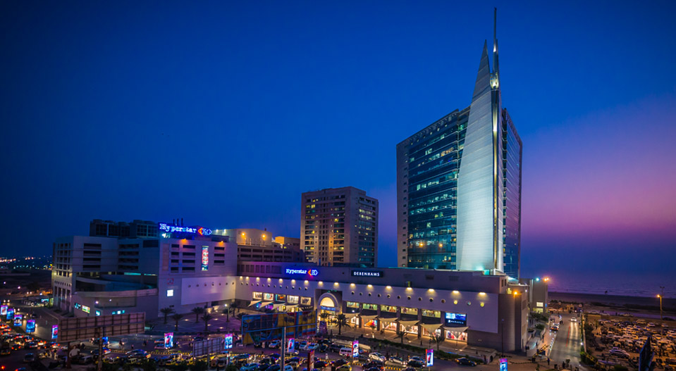
The old casino building was torn down in the early 2000s and in its place a huge shopping mall was constructed.
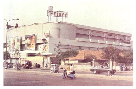
Prince Cinema in 1979. Karachi always had the largest number of cinemas in Pakistan. Prince was completed in 1976 and was the only cinema in the country with a 70mm screen.
Neuplex. Conventional cinemas declined giving way to multiplexs. Neuplex in Karachi is one of the largest in the country.
The shrine of Sufi saint Abdullah Shah Ghazi in Karachi in 1960. Ghazi is also known as the ‘patron saint of Karachi.’
The shrine today.
A sea canal near Queen’s Road (now Tameez-ud-Din Road) in the early 1950s.
The same area today.
Nazimabad in 1960s. It was a barren area with just a few villages at the time of Pakistan’s creation. In the 1950s the government started to build a housing colony here.
Nazimabad today.
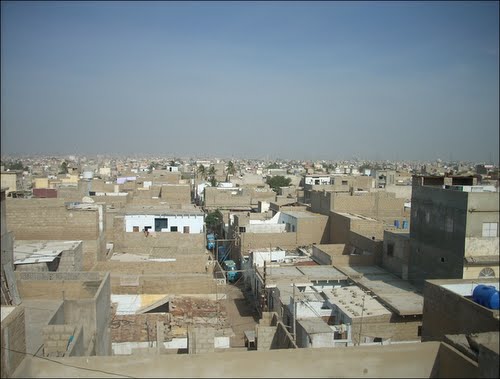
Karachi’s working-class area, Lyari in the 1910.
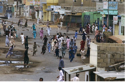
Lyari in 1983. It was a political hotbed of opposition parties during the Gen Zia dictatorship in the 1980s.
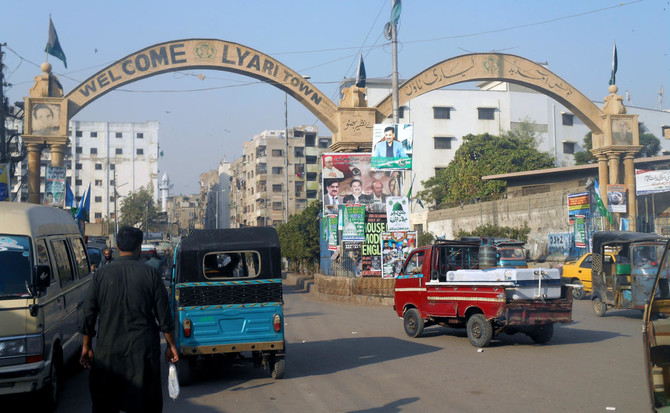
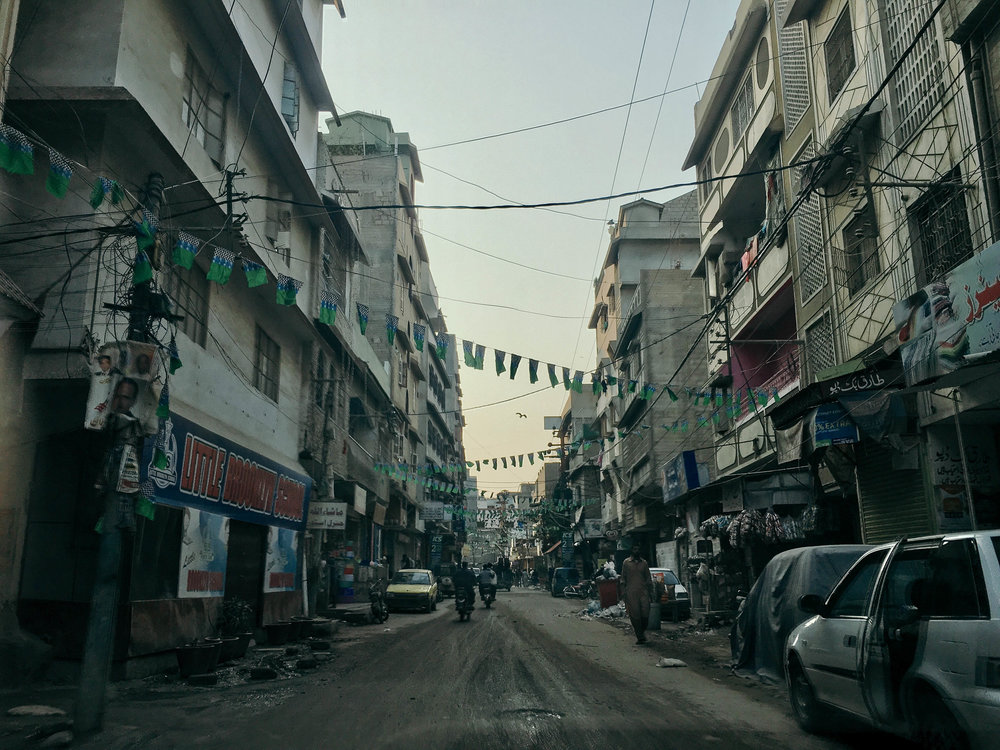
Lyari today. In the last decade the area was ravaged by gang warfare. Ever since 2015, things have begun to settle down somewhat. It remains to be the city’s most impoverished locality.
Karachi’s Gora Kabaristan (White Graveyard) in the 1930s. It was built by the British in the late 19th century and was used to bury British residents of Karachi.
The graveyard today. After Pakistan’s creation in 1947, it was handed over to the local Christian community.
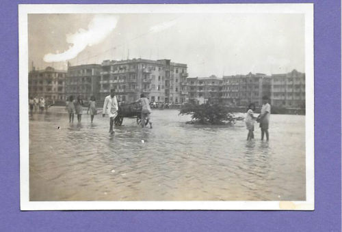
Karachi, 1967. Heavy rains flood the roads. Monsoons in Karachi are unpredictable. Some years they can be largely dry, but some years they can be extremely wet and problematic.
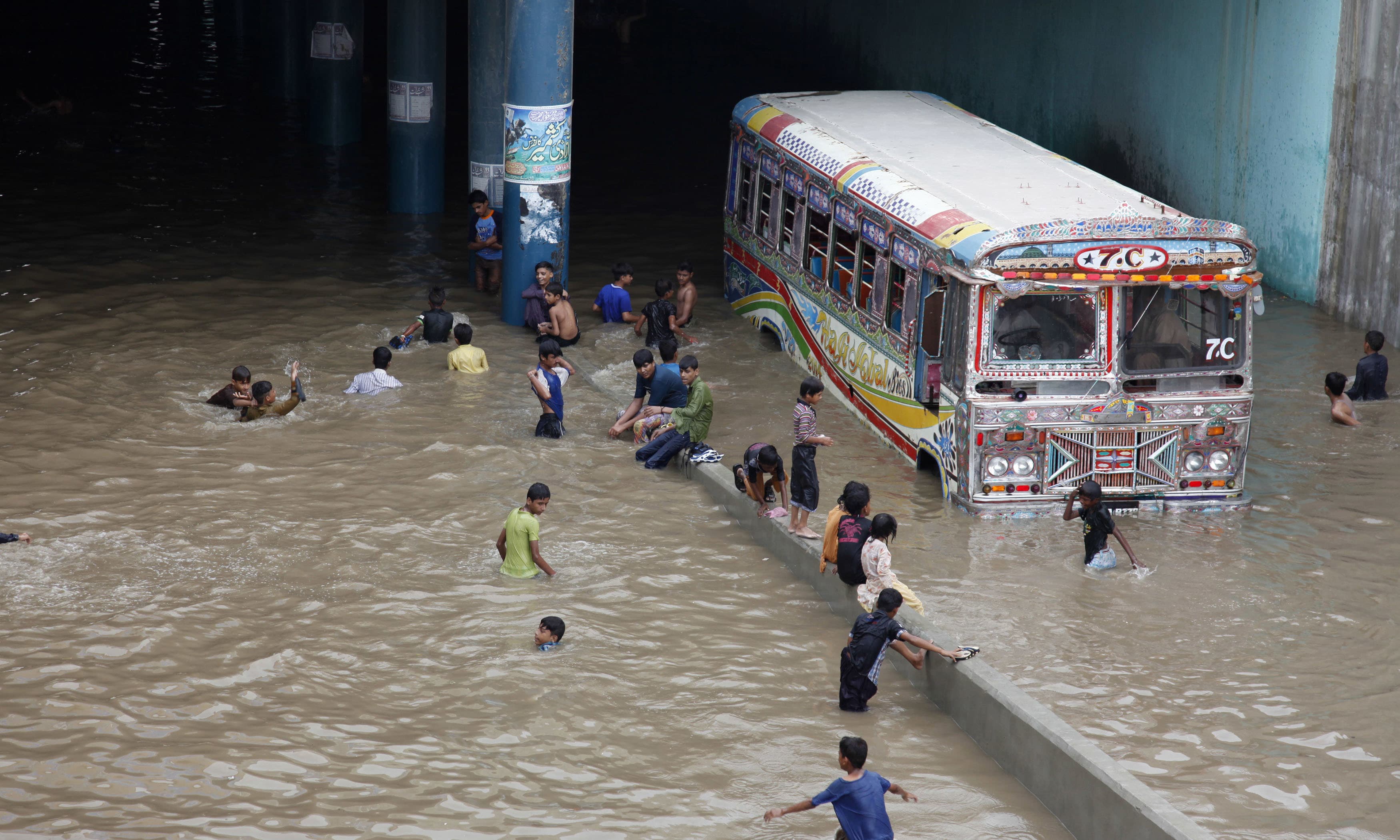
Karachi, 2017. An underpass flooded by rain water.
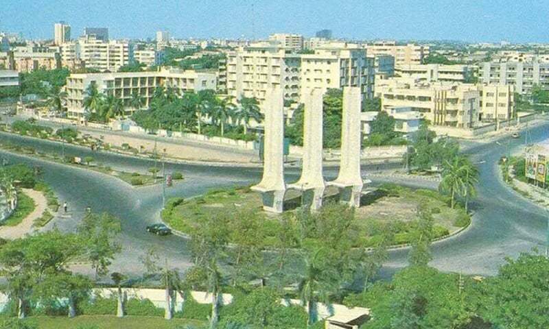
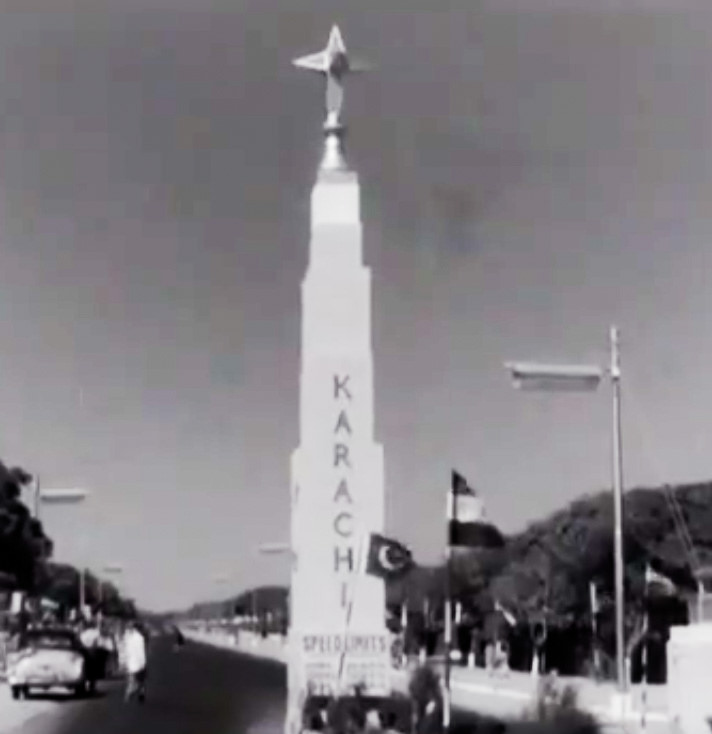
Karachi’s famous Teen Talwar (Three Swords) monument in 1975.
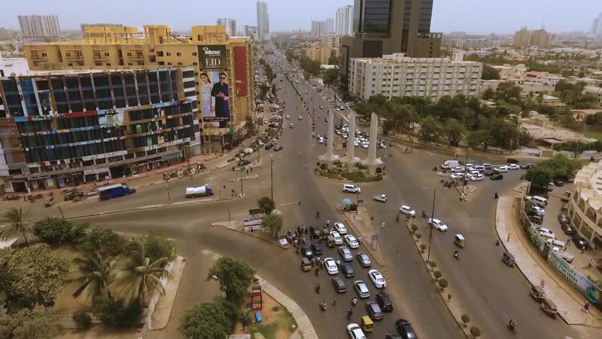
Three Swords today.
Karachi’s Kiamari area in 1910.
Kiamari today.
Karachi’s Drigh Road on the eve of Pakistan’s creation in 1947.
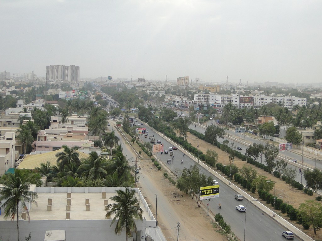
Drigh Road in 1983. It had been renamed Shahra-e-Faisal in 1975.
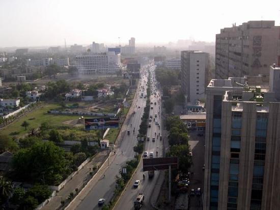
The road today.
Facts
- Karachi is Pakistan’s largest city.
- It is the capital of the country’s Sindh province.
- It is also Pakistan’s most populous and world’s sixth most populous city.
- It is the country’s economic, commercial and industrial hub.
- Karachi is also known as Pakistan’s ‘entertainment capital’ and ‘city of lights.’
- It has a long coastline along the Arabian Sea.
- It has two seaports, two airports and two main railway stations.
- The city is multicultural and cosmopolitan. The following ethnic groups are prominent:
- Mohajir (Urdu-Speakers) 43 percent
- Pashtun (including Afghans) 22-25 percent
- Punjabi 14 percent
- Sindhi 7 percent
- Baloch 6 percent
- Sariki 5 percent
- Bengali/Burmese 2-3 percent
- Karachi has the largest number of hospitals, schools, colleges, universities and charity organizations in Pakistan.
- The city has over 10 beaches and 8 islands.
- It also has one of the highest crime rates in the country. Since 2015, a crackdown by law enforcement agencies has been successful in somewhat bringing down the rate of ‘heinous crimes,’ but crimes such as muggings are still rampant. Gangs dealing in drugs, weapons and involved in kidnapping, extortion and gang warfare were a major issue till the recent crackdown against them. Some of them still operate in the city’s slums. Religious extremist outfits too began to set up shop in the city’s most congested and downtrodden areas. They too were involved in various serious crimes. But from 2015 onward, many such outfits have been eliminated.
- The city generates over a third of Pakistan’s tax revenue and over 20 percent of the country’s GDP.
- The city’s climate is arid. It has long summers (April-October). The hottest months are May and June. Monsoons begin in mid-July and can last till mid-September. But rains are unpredictable. Long dry spells are often followed by extremely wet ones. The summers, especially after June, are made better by a steady sea breeze. The mercury can jump to over 40c in May and June. Winters begin to set in from mid-November. They are entirely moderate. Some rain can fall in January which is the coldest month with average temperatures being between 10c and 24c. December, January, February and much of March are the most pleasant months.
- The city is also considered to be Pakistan’s most pluralistic. The three dominant political parties here are the secular Mohajir nationalist outfit, MQM; the centre-right PTI; and the centre-left, PPP.
A 1910 map showing the empire of ancient Greek king and warrior, Alexander the Great. On the map is also a large area which today is in Pakistan. Alexzander entered the region in 326 BCE through the Khyber Pass. His forces fought their way across areas which today are in northern and central Pakistan. He exited the region by travelling south on River Indus across Sindh. After entering the region’s southern-most region (what today is Karachi) Alexander entered Babylon (ancient Iraq) through Makran in the present-day Pakistani province of Balochistan.
The area marked on the map with a red circle is where the forces of one of Alexzander’s admirals, Nearchus, arrived. That area is Karachi. According to Nearchus’ writings, ‘a great storm was raging’ when his men arrived here. He added that there was just a tiny village of ‘primitive fishermen’ here.
Undated painting of Arab commander Muhammad Bin Qasim and his army at Daybal. In 712 CE, Qasim invaded Sindh. The first city he conquered was Daybal. Daybal was near what today is Manora in Karachi. According to ancient Arab sources, Daybal was situated by the Arabian Sea. Sources also tell that the city was guarded by Rajput soldiers and was largely populated by Brahmins. In the 16th century, Arab navigator, Al-Mahri Umdah, called it ‘Ras Karasi.’
Manora today. An old Hindu temple can be seen in the background.
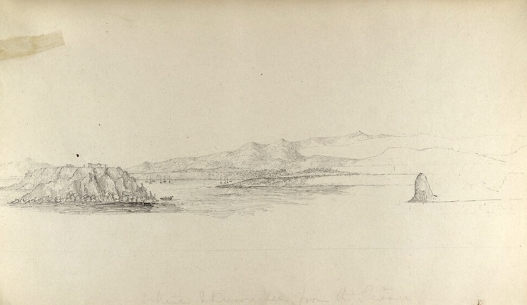
An early 19th century sketch of Daybal that had become ‘Dirbo’ in the 18th century. It was still a small fishing hamlet dependent on a fresh water pool. It also became known as ‘Kolachi Jo Kun’ (Kolachi’s Well). The population was a mixture of Hindus and Muslims. The main languages were Sindhi and Balochi. The Sketch was made by British traveler George Boyd.
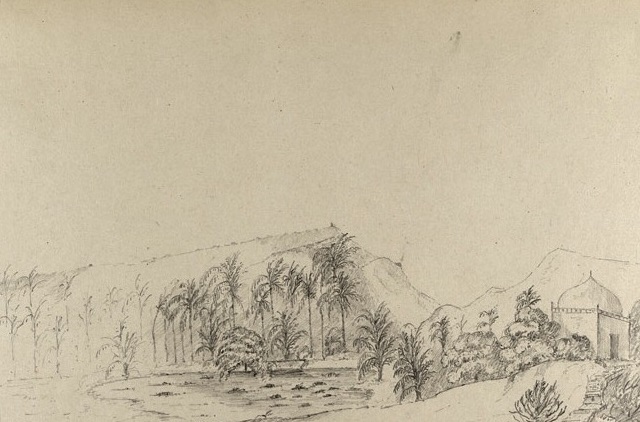
Another old sketch by George Boyd. It is of an area which today is called Manghopir in Karachi. The sketch shows a Sufi shrine (of 12th century saint, Pir Mangu) and a pond with crocodiles.
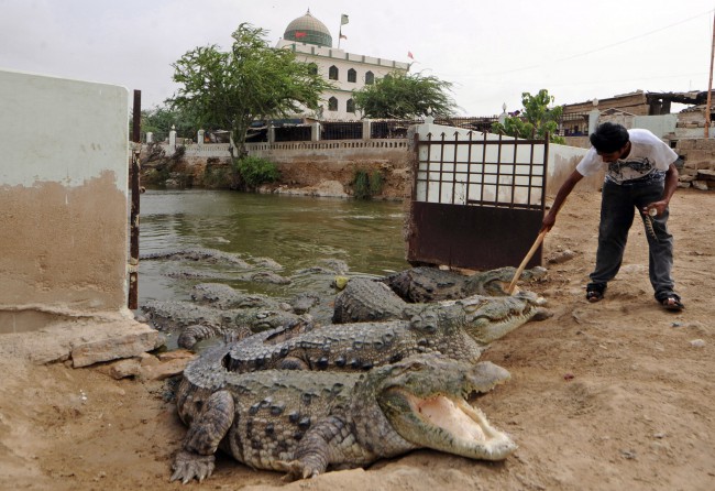
Manghopir today. The pond still has over a hundred crocodiles.
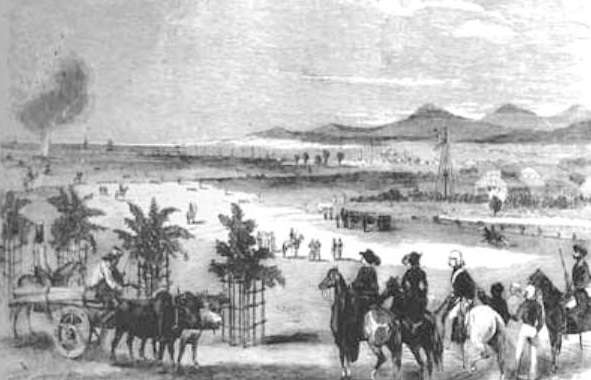
An 1844 sketch by Thomas Studdert showing British soldiers stationed in Karachi. The British began their conquest of the city in 1839 CE. They defeated the forces of the Talpur dynasty. The British renamed the city, Karachi. The sketch shows British troops doing rifle practice in what today is the city’s PECHS area.
The PECHS today.
An 1860 photograph of one of the first churches to be built in Karachi. It was called Trinity Church and was completed in 1855. The British were the first Christian residents of Karachi.
The Trinity Church today.
The Karachi Harbor in the 1870s. In the 1860s it had become an important harbor during the American Civil War when large amounts of cotton from Sindh were exported to the US government from here. This resulted in an economic boom which aided the once small town of Karachi to become a successful port city.
The Karachi Harbor today.
An 1890 photograph of Frere Road (now Fatima Jinnah Road).
Fatima Jinnah Road today.
Karachi’s Kharadar area in late 1890s. As the city’s size and economy grew, so did its population. Many migrants from the rest of India began to arrive and settle here. The city’s infrastructure began to collapse. In the 1890s, the bubonic plague swept the city, killing hundreds of people, especially those living in congested areas such as Kharadar.
Kharadar today.
The Clifton Beach in 1920s. Clifton was a barren seashore called ‘Hawa Bandar.’ The British began to build ‘summer homes’ here for themselves. Their families used to move into these houses during the city’s punishing summers. There were no fresh water connections here at the time, no electricity and only a rough road connected it with rest of the city. The British believed ‘Clifton air was good for health.’ From the mid-1920s, the city’s Zoroastrian families began to build permanent homes in Clifton, followed by rich Hindus and Muslims.
The Clifton Beach today.
The Karachi Airport being built in the late 1920s. It became the first ever airport in India.
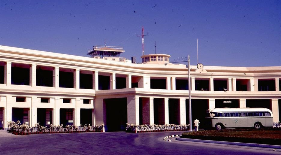
The Karachi Airport in the 1960s. It became one of the busiest in the region at the time.
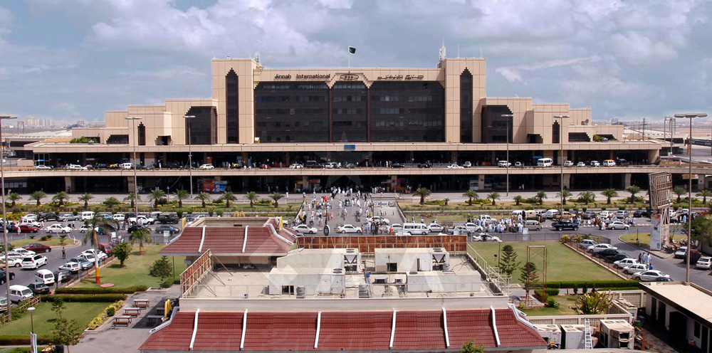
In 1992 a new airport, Jinnah International, was inaugurated in the city. It became Karachi’s second airport.
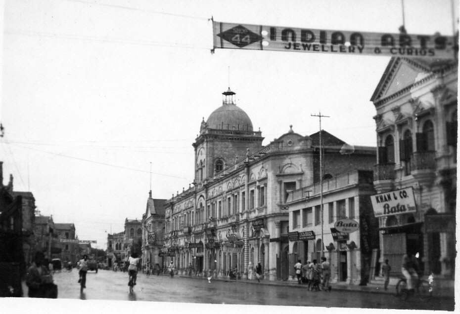
Elphinston Street in the 1930s (Saddar). Saddar was developed as a ‘posh’ shopping area by the British. It was lined up with high-end shops, stores and bars.
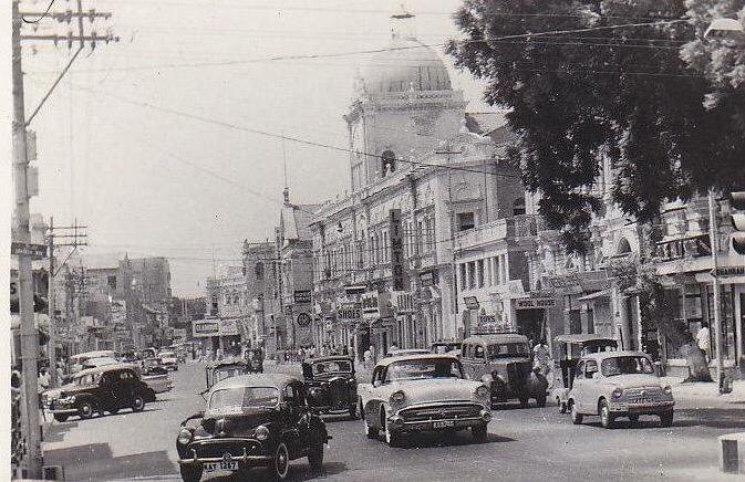
Elphinstone Street in the 1960s. Saddar remained to be a popular area after Pakistan’s creation. Between the 1950s and 1970s it became known for its busy bazars, nightclubs and bars.
Elphinstone Street today. Saddar begn to lose its charm from the 1980s onwards.
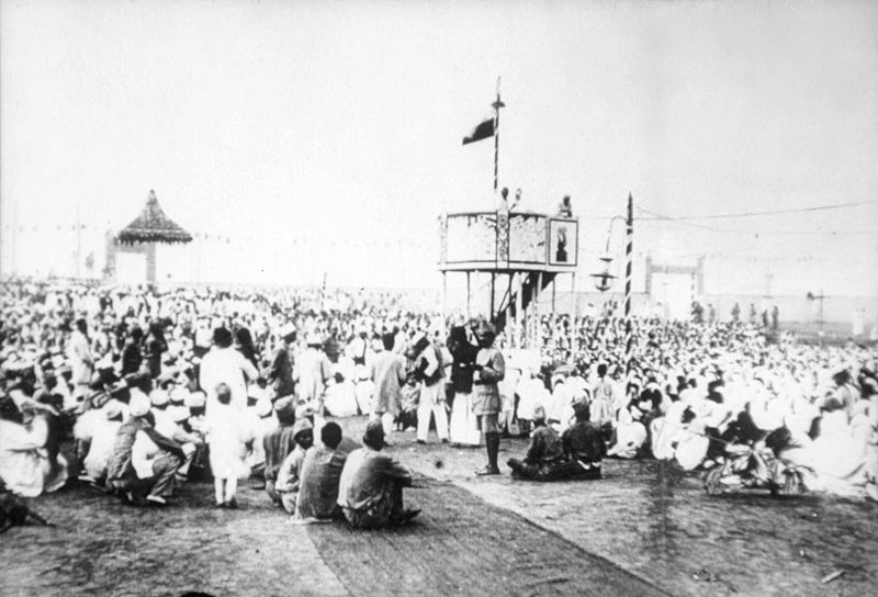
A Congress Party rally being held at Karachi’s Patel Park in 1931. 51 percent of Karachi’s population at the time was Hindu.
People celebrate the creation of Pakistan at Patel Park in August 1947. The park’s name was changed to Nishtar Park.
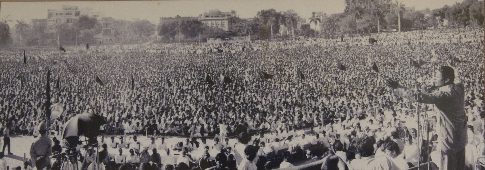
A Pakistan People’s Party election rally at Nistar Park in 1970.
Nishtar Park today.
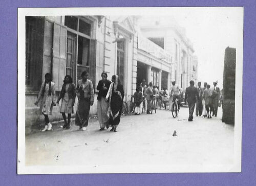
Goan Christian, Hindu and Muslim women on a shopping trip at Karachi’s Preedy Street area in 1948.
Preedy Street today.
Mcleod Road in the early 1950s. The British had developed this area as a financial district. In the 1960s, it was renamed I.I Chundhrigarh Road.
I.I Chundrigarh Road today. It began to be known as ‘the Wall Street of Pakistan.’
The Hotel Metropole in 1951. Built in 1950, it was the city’s first major hotel. It was also famous for its many restaurants and bars.
Today the famous hotel is being torn down to make way for a new building.
The first US Embassy in Pakistan was situated in the Kandawala Building on Bandar Road.
In 1961 the embassy moved to a building on Fatima Jinnah Road. The building was designed by the famous modernist architect Richard Neutra.
In 2011, the embassy moved to new premises on the Mai Kolachi Road.
The mausoleum of Pakistan’s founder, Mohammad Ali Jinnah, being constructed in 1967. It was completed in 1970.
The mausoleum today.
A press ad for Benmore whisky. Karachi was the largest market in Pakistan for local and imported alcoholic beverages. In April 1977 sale of alcoholic beverages was banned through an ordinance. The Ordinance lapsed in 1978. In 1979, a fresh ordinance was introduced. However, both the ordinances allowed sale of alcoholic beverages to non-Muslim Pakistanis and tourists. Even though bars, liquor stores and nightclubs were shut down, ‘licensed wine shops’ were allowed to sell to non-Muslims. 5 and 4 star hotels too were allowed to serve alcohol to tourists.
Karachi has the largest number of licensed wine shops in the country.
Western tourists at a beach in Karachi in 1964.
A Karachi beach today. There are over 10 beaches in the city.
Karachi’s once famous Palace Hotel in 1963, the year it was declared to be ‘one of the best hotels of Asia.’ Situated on Club Road, Palace lasted till 1982 when it was torn down.
Palace Hotel was sold and then demolished in 1982. In its place, the Sheraton Hotel came up. Today it is called Movenpick Hotel.
Korangi in early 1960s. This vast barren land was developed as a residential and industrial area in the 1960s.
Korangi today.
The National Stadium being built in the early 1950s. Completed in 1955, it became (and still is) Pakistan’s largest cricket stadium.
The National Stadium today.
The casino which never opened. It was completed in 1977 and was situated in the Sea View area of Clifton. It was supposed to be one of the biggest casinos in the region. Its launch was scheduled for April 1977. However, its grand gala opening was cancelled when a protest movement by an alliance of right-wing parties forced the left-leaning ZA Bhutto government to ban alcohol and nightclubs. The building stood there aimlessly for decades until it was finally torn down in the early 2000s.
The old casino building was torn down in the early 2000s and in its place a huge shopping mall was constructed.
Prince Cinema in 1979. Karachi always had the largest number of cinemas in Pakistan. Prince was completed in 1976 and was the only cinema in the country with a 70mm screen.
Neuplex. Conventional cinemas declined giving way to multiplexs. Neuplex in Karachi is one of the largest in the country.
The shrine of Sufi saint Abdullah Shah Ghazi in Karachi in 1960. Ghazi is also known as the ‘patron saint of Karachi.’
The shrine today.
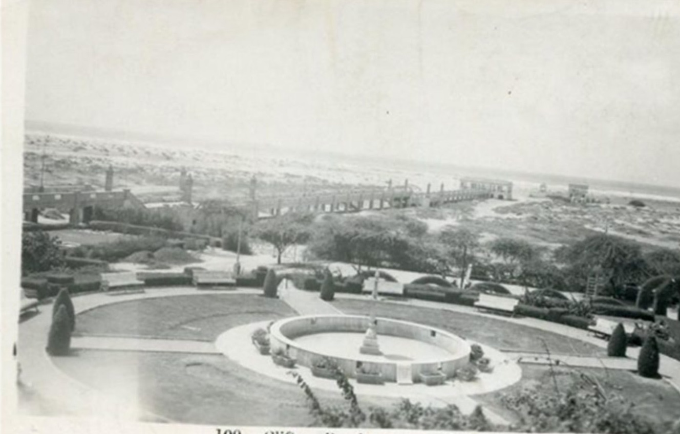
A sea canal near Queen’s Road (now Tameez-ud-Din Road) in the early 1950s.
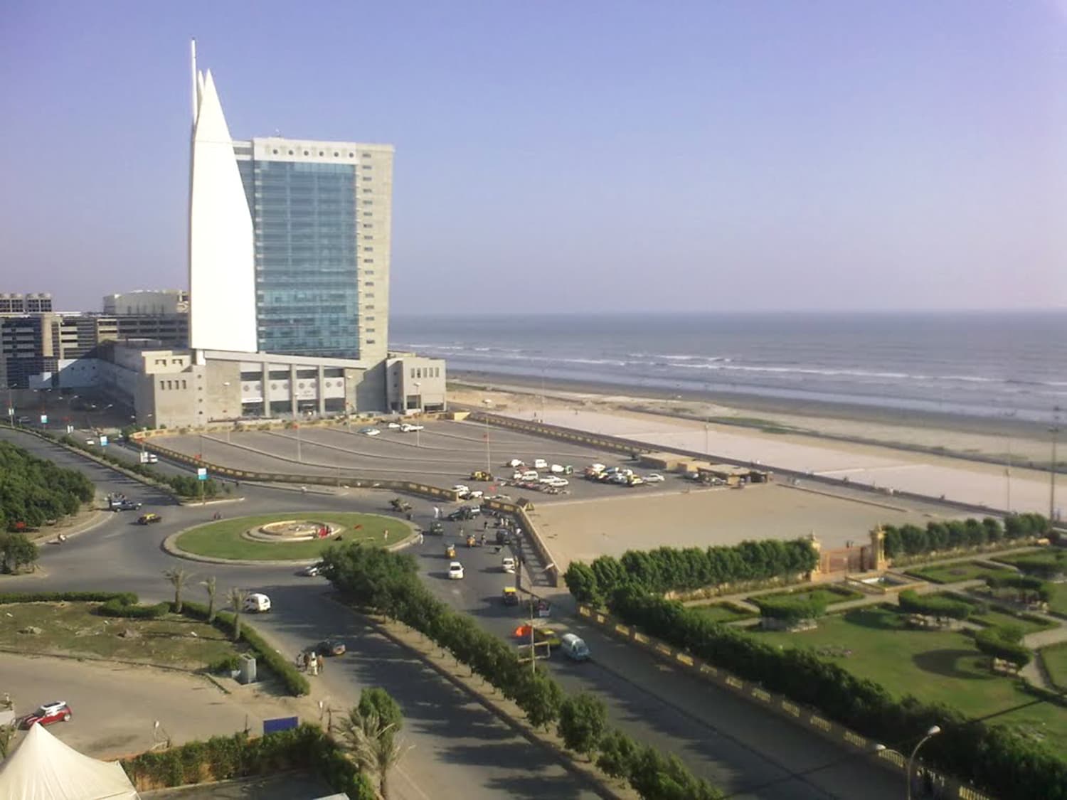
The same area today.
Nazimabad in 1960s. It was a barren area with just a few villages at the time of Pakistan’s creation. In the 1950s the government started to build a housing colony here.
Nazimabad today.
Karachi’s working-class area, Lyari in the 1910.
Lyari in 1983. It was a political hotbed of opposition parties during the Gen Zia dictatorship in the 1980s.
Lyari today. In the last decade the area was ravaged by gang warfare. Ever since 2015, things have begun to settle down somewhat. It remains to be the city’s most impoverished locality.
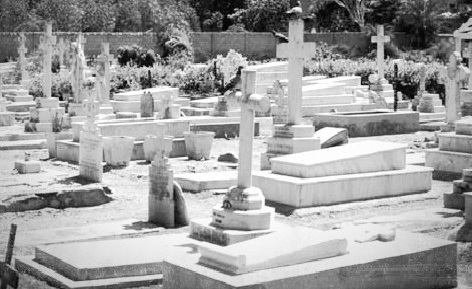
Karachi’s Gora Kabaristan (White Graveyard) in the 1930s. It was built by the British in the late 19th century and was used to bury British residents of Karachi.
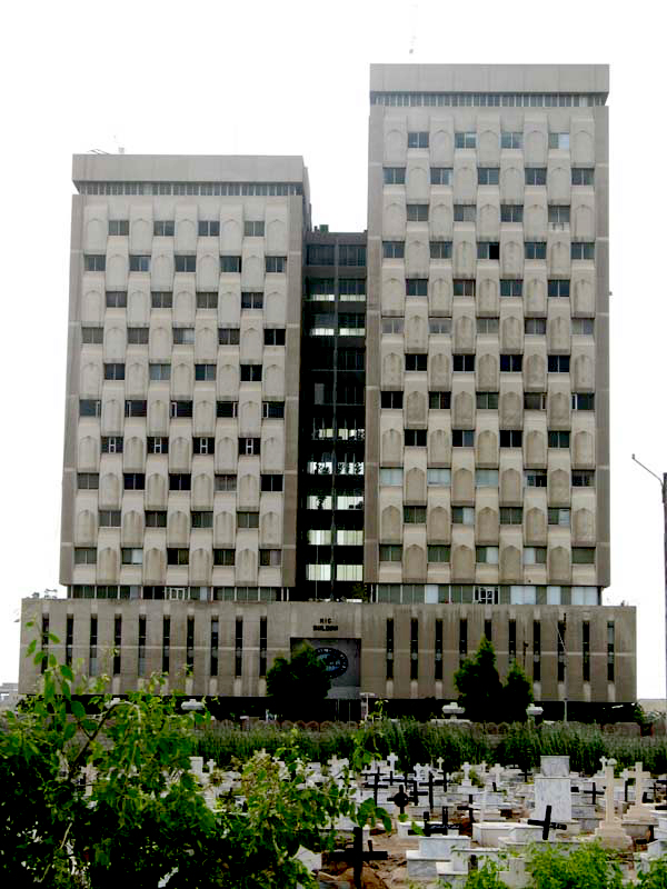
The graveyard today. After Pakistan’s creation in 1947, it was handed over to the local Christian community.
Karachi, 1967. Heavy rains flood the roads. Monsoons in Karachi are unpredictable. Some years they can be largely dry, but some years they can be extremely wet and problematic.
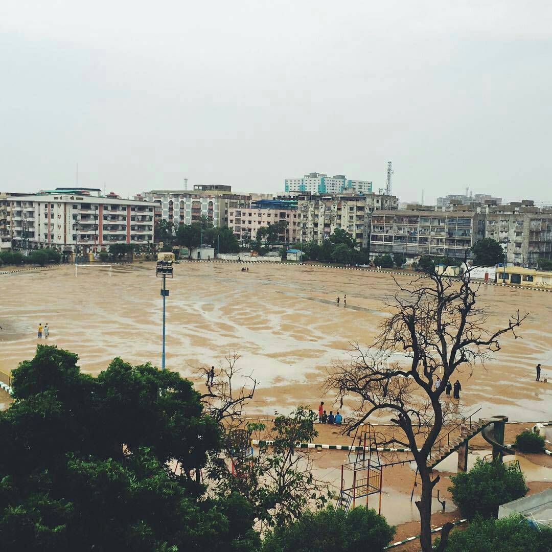
Karachi, 2017. An underpass flooded by rain water.
Karachi’s famous Teen Talwar (Three Swords) monument in 1975.
Three Swords today.
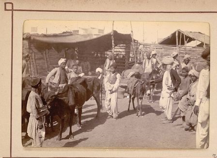
Karachi’s Kiamari area in 1910.
Kiamari today.
Karachi’s Drigh Road on the eve of Pakistan’s creation in 1947.
Drigh Road in 1983. It had been renamed Shahra-e-Faisal in 1975.
The road today.